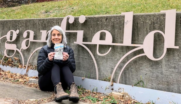
One down, 89 to go. Artist Lisa Valentino having just completed walking every street in Garfield.
At the Orbit, we like to think we’ve, you know, been around. To have at least set a foot in all of Pittsburgh’s 90 neighborhoods, sure, but also up city steps and down back alleys, poked behind dumpsters and into collapsing buildings, we’ve partied with weed-eating goats on the South Side and wild turkeys in Allegheny Cemetery, we know where the wild blackberries can be picked in June and the pawpaws fall in September.
All that bragging and when it comes to seeing Pittsburgh–like, really seeing Pittsburgh–we’re still holding Lisa Valentino‘s Olde Frothingslosh.

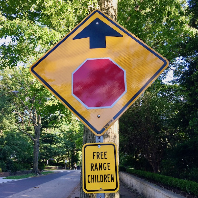
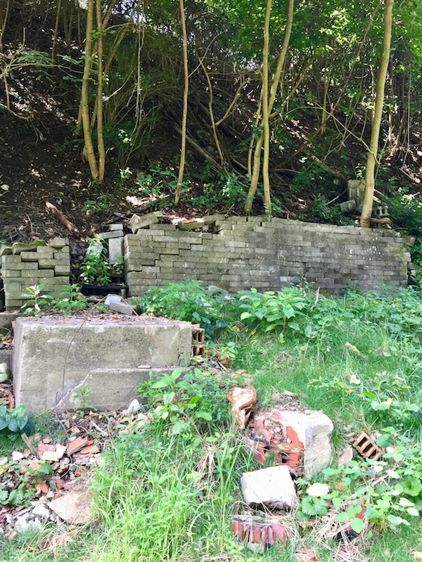
IRL word cloud for the Orbit: Heaven and Hell, sin and blood. Front yard decoration in Lincoln-Lemington-Belmar.
Valentino is an artist by day and an urban hiker by … the other parts of the day. Five years ago she set out with the ambitious goal of walking all the streets of Pittsburgh. That project–usually shortened to the acronym WATSOP–takes an impressive amount of discipline, organization, and physical stamina, but we’re consistently bowled-over by Valentino’s oddball finds in the field.
Yeah, sure–I’ve been to Lincoln-Lemington plenty of times–but never came across the Heaven & Hell painted garden edger thingamagigs. And how about the Valentine’s Day skeleton of Brookline? It was Lisa who hooked us up with Barbie’s Dream Cult in Polish Hill.
SO, we thought it was high time to check in with Valentino and find out what’s up with WATSOP, how she came up with the project, keeps track of where she’s been, and what she’s learned along the way.
Editor’s note: Typically, for a story like this, we’d do a walk-along to chronicle the process. But between the timely need for social distancing and the fact that Lisa’s photos are already so great, this story involved zero field work. All photos courtesy of Lisa Valentino.

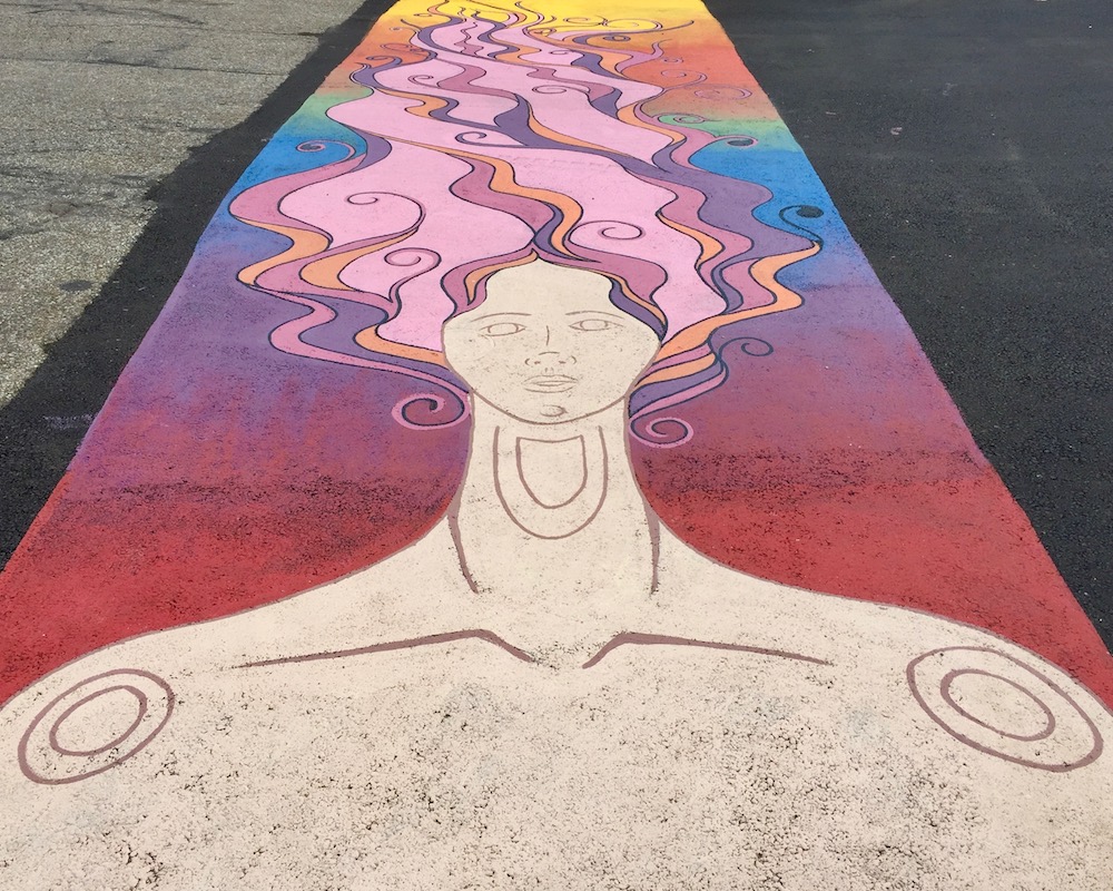
Barbie’s Dream Cult, Polish Hill
How did you come up with the idea to walk all of Pittsburgh’s streets?
First, for four years I had been doing Project 365–take one photo every day and post on social media. At four years one exhausts everything familiar (yes, one day I photographed all the doorknobs in my house at the 11th hour). I was already in the habit of searching and exploring for something different and new to catch my eye.
Then I stumbled upon Félix de la Concha’s One A Day at the alumni hall at Pitt. His 365 paintings of the Cathedral of Learning from as many different perspectives got me really noticing when the iconic building would pop into view as I traveled in and out of the city. One day, while starting the climb to the slopes on a walk in the South Side I saw the Cathedral in the distance and wondered “from how many locations will I see a view of the Cathedral?” Then it hit me…. “Let’s find out!” And “what else will I find?” And “Why not walk ALL THE STREETS OF PITTSBURGH to SEE what I will find?!” And there it was!
View of Oakland and Pitt’s Cathedral of Learning from the South Side Slopes
What are the parameters of the project?
When I set off to do this, the first hurdle was finding a map! Many Pittsburgh maps only encompassed areas close to downtown. Maps that included a bit of a wider range did not have enough detail to show every street. So I began to search for any map that would show and name my two block street in Point Breeze.
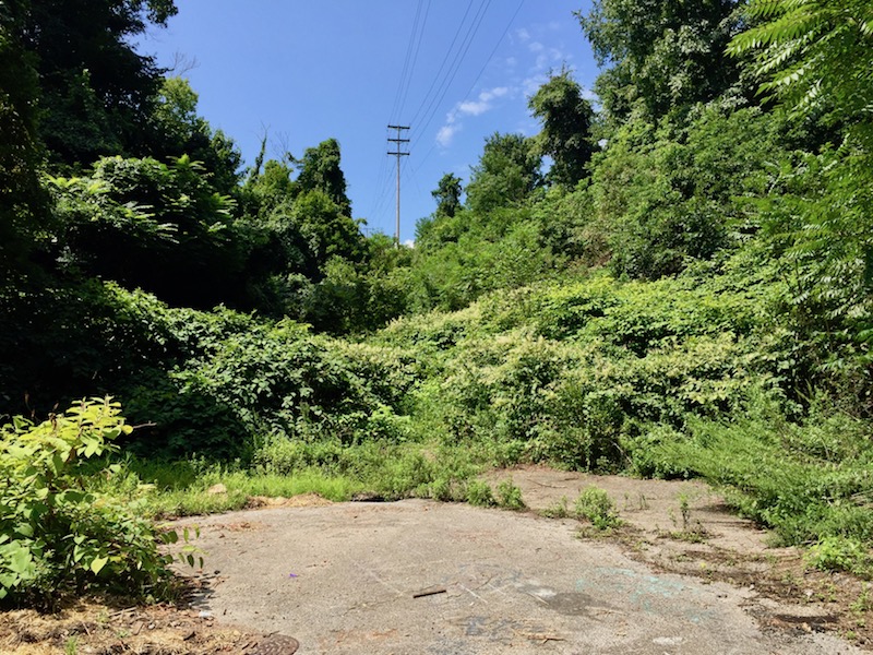
After settling on the perfect map, a Bike Pittsburgh Map, I started marking off my walked streets. If it’s on the map, I walk it. As the years have gone by several new streets have popped up that are not on my map, but more surprising are the number of streets that seemed to have disappeared. Most due to abandonment, I suppose. Overgrown with trees and weeds and barely a path to indicate a street was ever there.
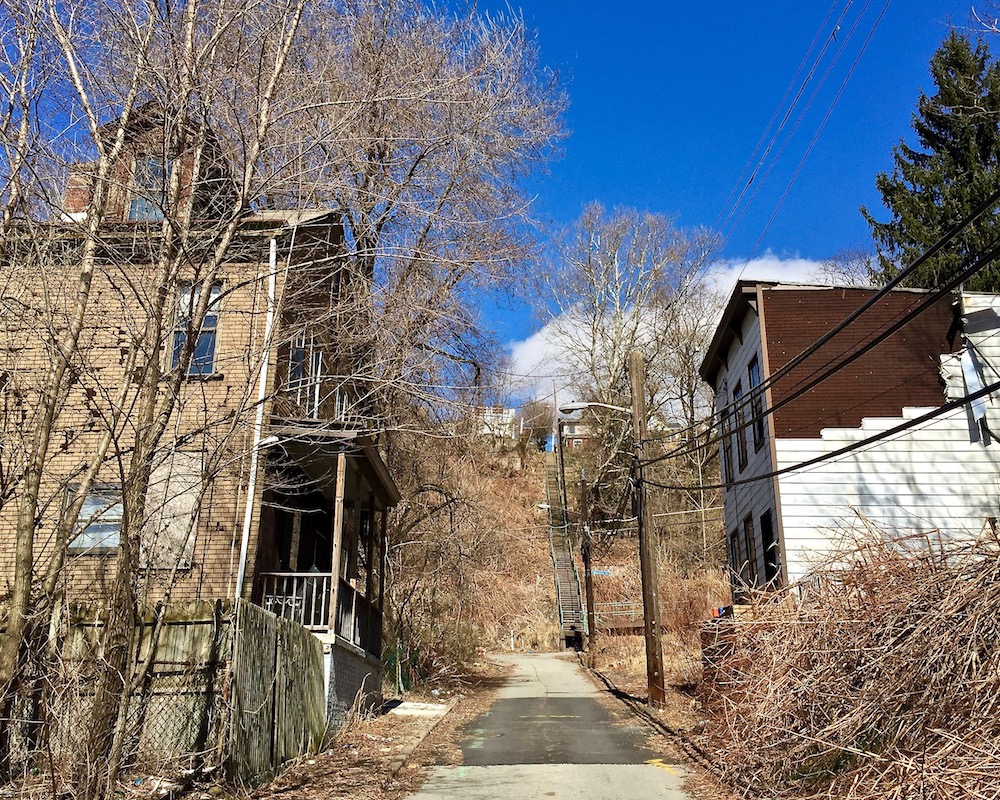
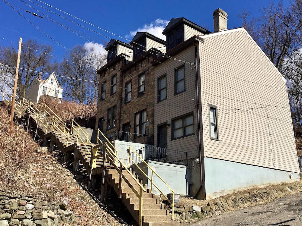
I walk every street, alley, and dead-end in the city. I will not do the highways/parkways unless there is a patch that keeps me off those busy roads. I only do city steps if they get me from one street to another. Because they are not on the Bike Pgh map, I don’t count them as walking the streets. (Perhaps someone needs to come up with a Walk Pgh map?) Though I will say, there is nothing more delightful than stumbling upon a set of city steps to take me to the next street and avoiding doubling back from where I just came!

“I walk every street, alley, and dead-end in the city.” Homewood
When did you start? Do you have an estimated completion date?
My first intentional Walking All the Streets of Pittsburgh walk was May 18, 2015. When I started I foolishly thought I could finish in one year. I suppose if I did nothing else in the year and suffered no setbacks I could have. I mean, it’s easy to walk 1000 miles in a year, right? Averaging less than 3 miles a day?! But life never works that way. Twice I lost months of walking due to back problems that left me unable to do much more than lay on the floor watching the Hays eagle cam for weeks at a time!
As I approach the anniversary with nearly five years under my belt, I would love to finish by May 18, 2020. But that looks unlikely. You know, life.

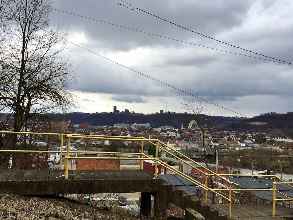
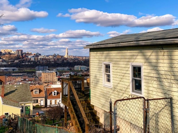
View of Allentown and top of the USX Tower from Knoxville
How often do you walk (for the project) and for how long? How do you plan the schedule for the walks?
When I started walking, I walked everywhere I could from my house in Point Breeze: to Squirrel Hill for shopping and movies; to Regent Square and Shadyside for lunch and dinner dates with friends. To doctors appointments in Oakland. I jumped on any reason to walk from my house to anywhere I had to go.
Then any time I needed to get in the car to travel somewhere I’d squeeze in a chance to walk before coming back home. Visiting family in the South Hills had me stopping to cross off streets in southern neighborhoods. I’d Google laundromats and search for ones in outlying neighborhoods so I could walk between cycles. I looked forward to appointments and meetings as another opportunity to explore a new neighborhood.
The length of the walks and number of times I walked each week varied depending on my schedule, my health, the weather, and hours of daylight. I would stop to cross off one street in a sea of walked streets as I drove past a neighborhood, or, in the summer with its long hours of daylight, I’d do two big walks, one in the morning and one in the evening while the light lingered.
These days I find myself needing to drive about a half hour each way to get to a neighborhood where I need to walk, having completed most of streets in the Triangle (east of the Point).

The Valentine’s Day skeleton of Brookline
How do you track where you’ve been?
After a walk I’d take a Sharpie to the Bike Pgh maps to cross off streets. I had one copy of the map I’d take with me on walks as reference, and one hung on my wall as a display. I soon began using the MapMyWalk app to track my route because it became hard to remember and focus on the route, especially while walking with friends. Then the map became hard to read. With all those Sharpie route tracings, it was a less reliable resource for where I still needed to walk. So I began marking my walks in Google Maps. While the travel map is tattered and torn beyond usefulness, I do still use it fas a prop or my final picture in a completed neighborhood. And the display map hangs proudly on my wall and is updated after each walk.
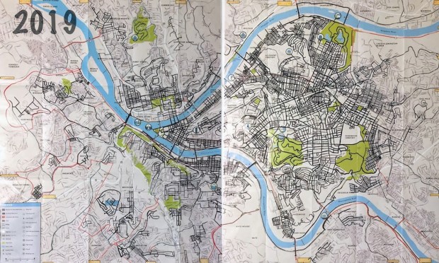
Valentino’s “display” copy of the Bike Pittsburgh map, marked with all currently-walked streets (as of some point in 2019)
Now that you’ve been doing this a while, what’s the biggest difference between your pre-project expectations and the reality of the walks?
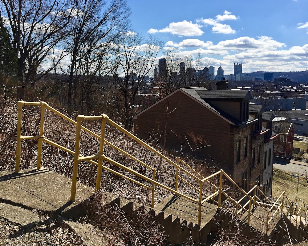
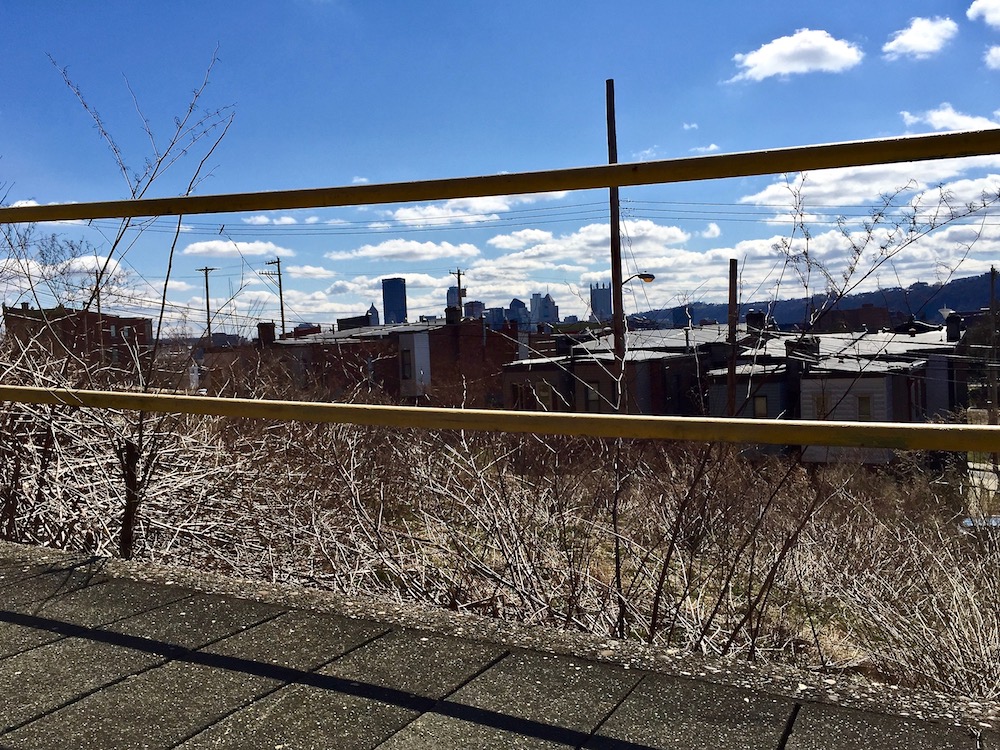
Well, if the project started as a quest to see the various viewpoints of the Cathedral of Learning, I can say that I’ve added to that the many wonderful views of downtown beyond Mount Washington. Not just those northern neighborhood views that were entirely new to me, but also the delightful surprise of turning a corner in a southern Hilltop neighborhood to see the very tops of the tallest buildings peeking over the horizon or sandwiched between two houses.
I have also become quite obsessed with water towers. Not only for their unique design and a new appreciation for the engineering to keep satisfactory water pressure in our homes. But also as the best orientation markers the city has to offer. You can view the city skyline and the Cathedral of Learning as a compass pointing you to downtown and Oakland, but seeing the bulbous water tower of the Upper Hill and the Garfield water tower in the same view allows me to put in perspective all the neighborhoods at once.
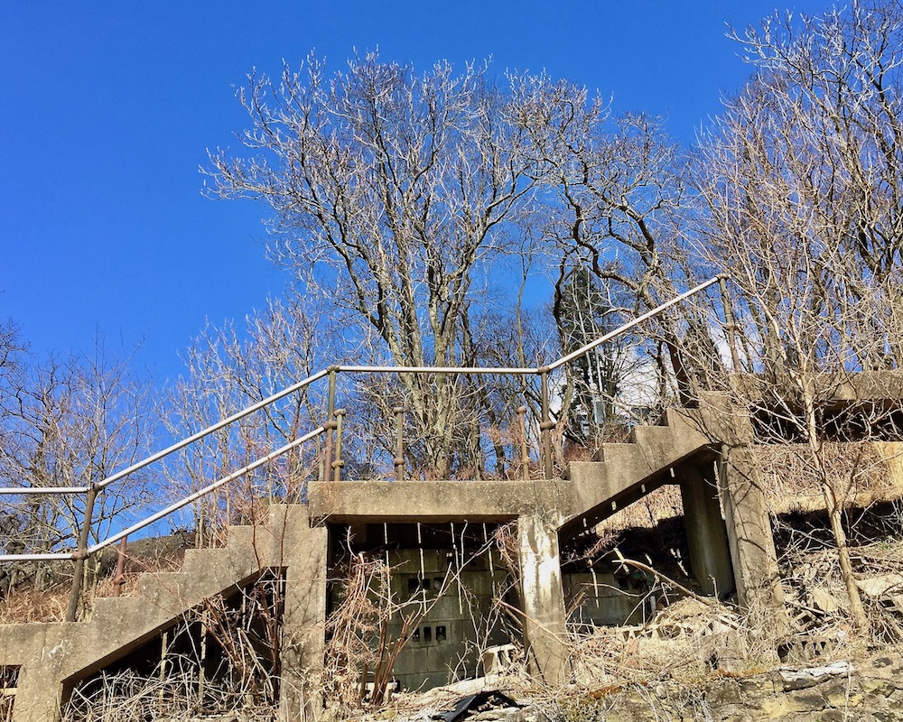
Holy Hell, these hills! I know they say Canton is the steepest, but thankfully it is quite short. And when walking straight up them I can name a number of streets that seems to have access to the same claim (most of them also in Beechview)! It hadn’t occurred to me that such a hilly terrain is somewhat unique in this country until a friend from Illinois commented on them. I love the city for the hills and the views they provide, and I curse them when I’m tired and the only way to go is UP!
Holy Hell, these hills! City steps, Troy Hill.
What is/are the biggest disappointment(s) you’ve experienced through the project?
Oddly enough, it’s been the number of warnings I’ve gotten to avoid certain areas. To date, I have never had a problem walking in any of the neighborhoods. And in “those” neighborhoods, if anything, I have found THE nicest, most friendly Pittsburghers!

Spring on the South Side Slopes
If you had an hour-long sit-down meeting with, say, Mayor Peduto (or other city planning officials) what would be your strongest recommendation for action based on what you’ve learned/seen in your project?
Preserve the city steps! This is such a unique, wonderful asset and a beautiful reminder of our pre-car days. [Editor’s note: A to the MEN!]
I love to walk, I love to bike, and I love having a car to get around. But I think people have forgotten that WE ARE ALL PEDESTRIANS and we are all pedestrians FIRST. Before we bike, before we own cars, we walk. And no matter how we get to our destination, we all need to walk those final steps. So I do hope the city continues to keep pedestrian accessibility a priority. Fixing city steps, maintaining and keeping sidewalks clear, dedicated crosswalks and other traffic calming measures to keep the pedestrians safe and motivated to travel by foot.

Valentino’s canine companion on a set of city steps, Perry North
Does such a close block-by-block inspection of the city make you more or less optimistic about Pittsburgh/America/humanity?
Humanity? I tend to run into very few people on my walks. I would say those that I do run into have been friendly, willing to talk and share stories and point out some things that might interest me. I always walk away with a newfound hope for humanity after those encounters, yes.
Pittsburgh? I know everyone has their preferences on this, but I am not excited to see all these big development projects popping up all over the place. Lawrenceville seems to be the worst of it. And of course there is displacement, which is a whole other issue. There is so much beauty and history that would be wonderful to preserve.

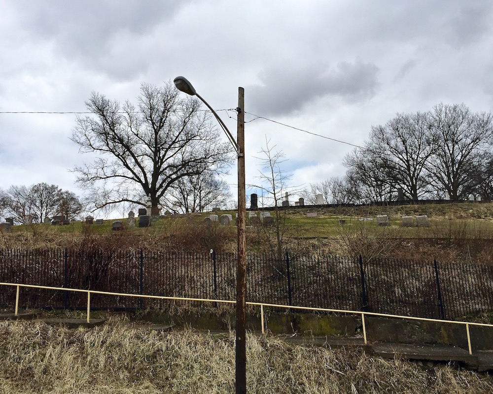
Rev. Murray, Hazelwood
What do you feel like you’ve learned through the project?
EASY!! I’ve fallen in love with this city!

Easy to love. Greenfield/”The Run,” Parkway east, and Cathedral of Learning.
I’ve heard there’s another person also attempting a similar walk-all-Pittsburgh-streets project (but I’m not in contact with her). Are you familiar? Have you ever crossed paths?
I am not at all proud of this, but my gut reaction was “someone is trying to steal my idea.” After I had committed about 4 years to this unique quest it hit me kind of hard. It has taken a while to come to terms with it, but in the end it helped me on my walks. Because we are often photographing the same quirky finds on our walks, it led me to feel less inclined to photograph everything. So on days that I’m being tangled by two puppies as I try to cover streets, I can let go of trying to get photographs. I know Megan will or has found those things already.
And, of course, her approach is much different than mine. She blogs about her walks with much detail and folks should definitely follow her. My approach has always been, as a visual artist, to explore and discover and photograph what I find interesting. My hope would be that by doing so I have encouraged people to want to go out and find or discover the hidden gems of this city for themselves. That is why I tend to give very little detail on where the photos are taken, beyond naming the neighborhood.

Valentino with map at the completion of walking Squirrel Hill
For more on Lisa Valentino’s art and creative projects, see her website LisaVCreative.com, Instagram @LisaVCreative, and WATSOP Facebook page.
Related: This story about one person’s quest to walk all of the things in the city can’t help but remind us of Laura Zurowski’s similar-but-different project to locate, climb, photograph, and blog about all 739 sets of city steps. More process, less volume, but equally fascinating. See: Step Beat: Talking Missed Connections and Mis.Steps with Ms. Steps (Pittsburgh Orbit, March, 2018).